

Roads Reimagined from Vintage Postcards
Join us as we recreate classic scenic drives using 1930s–1960s postcard archives, following clues from captions, postmarks, skylines, and road signs to rediscover lost overlooks, motels, and byways. Expect maps, side‑by‑side photographs, historical sleuthing, and stories gathered along the way. Share your family postcards, subscribe for new routes, and help us chart where the open road once shimmered in linen textures, Kodachrome colors, and chrome-bumpered reflections that still echo through today’s landscapes.
Reading the Clues Hidden in Ink and Edge Details
Tiny notations—“five miles west of town,” a torn corner near a motel logo, a faint cancellation ring—can unlock entire routes. We compare script styles, regional slogans, and studio imprints, then match roadside architecture, tree lines, and guardrail shapes. These breadcrumbs turn an image into coordinates, stitching together fragments until the old highway emerges, not as nostalgia alone, but as a traceable, navigable path that welcomes new travelers with informed curiosity and respectful footsteps.
Geolocating Vintage Vistas with Modern Tools
Using GIS overlays, historical USGS quadrangles, SunCalc shadow angles, and street-level archives, we triangulate where the photographer stood. We examine ridge contours, river bends, and storefront rooflines to confirm alignment. When angles disagree, we consider highway realignments, bridge replacements, and vanished turnouts before testing candidates on the ground. The process balances data precision with on-site intuition, leading to confident reconstructions and heartfelt moments when scenes from ink and pigment suddenly animate before your windshield.
Planning Safe, Scenic Reconnaissance Drives Today
Roads shift, shoulders narrow, and overlooks become private pull-ins. We plan daylight scouting, bring reflective gear, and favor legal turnouts. When the original vantage lies beyond modern safety, we seek ethical approximations that honor intent without risk. Seasonal closures, construction, and wildlife crossings guide timing. A backup route and printed map help if cell coverage fails. The goal is to recreate the experience, not jeopardize it, letting a historic view survive another cherished retelling.
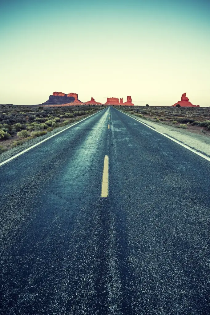
Tracing Routes from Paper to Pavement
Those cheerful roadside vistas weren’t random; every postcard captured an exact vantage that can still be found with patience. We decode hand-written margins, publisher codes, highway shields, telephone pole spacing, and mountain profiles, then reconcile them with modern maps, aerial imagery, and DOT documents. The reward is a drive plan that respects current conditions while honoring the historical view, letting you feel the original anticipation of cresting a ridge and watching a familiar silhouette reappear across decades.
Decoding Linen Texture and Early Color Processes
Linen postcards often feature stippled skies and saturated blues that never existed quite that way on location. We study lithographic screens, painterly retouching, and publisher palettes to avoid chasing illusions. By identifying where pigment embellished cloud edges or simplified tree masses, we infer true contrast and horizon placement. Knowing process quirks lets us align reality with representation, capturing the feeling without mistaking printing artifacts for geographic truth, and shaping modern photographs that respectfully echo yesteryear’s exuberant visual grammar.
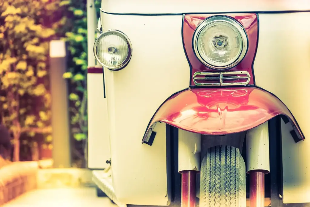
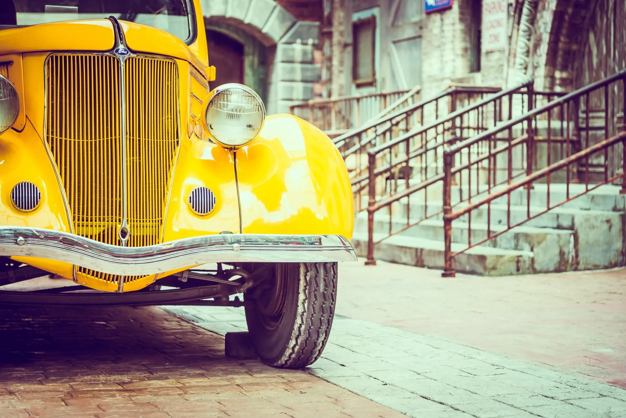
Recognizing Model Years on the Shoulder
Automobiles parked in foregrounds become timestamps. Grille bars, tail-light bezels, emblem fonts, and bumper overriders narrow ranges to specific seasons. We cross-reference brochures, club registries, and period ads to refine dates, then tie those years to highway design shifts or motel ownership changes. Identifying a 1957 fin or a 1941 hood ornament can confirm whether a byway existed before a bypass cut traffic. These details stabilize timelines, clarifying precisely which alignment hosted that postcard-perfect afternoon drive.
Calling the Reference Desk with Purposeful Questions
A good inquiry pairs specifics with openness: publisher name, suspected highway, and a scanned stamp, followed by patience for surprises. Reference librarians suggest vertical files, Sanborn maps, and forgotten newsletters that mention a gas station mascot or tollbooth cost. We document citations and reciprocate with digital copies of our findings. This respectful exchange transforms staff into collaborators, turning a solitary hunt into a shared project where every new fact becomes a mile marker toward rediscovering beloved scenery.
Recording Stories Beside Surviving Landmarks
Interviewing elders at the base of an original neon sign or beside a stone wall invites layered memory. We use small mics, consent forms, and open-ended prompts that welcome digressions about teenage joyrides, postcard carousels, or weekend migrations. On-site storytelling reconnects sensory cues—wind direction, diner coffee, truck downshifts—with postcard frames. Later, pairing audio snippets with photographs and maps preserves cadence and detail, ensuring the recreated drive carries voices as well as vistas across generations.
Cross-Checking Memory with Maps, Directories, and Weather
Reminiscences glow but occasionally blur dates. We triangulate claims with city directories, highway commission minutes, and archived forecasts that explain why tourists shifted routes during heavy snow years. Newspaper clippings verify motel name changes, while fire insurance maps confirm footprint continuity. This respectful verification doesn’t diminish personal recollection; it strengthens it, allowing a story to sit confidently beside an image, each reinforcing the other, until the reconstructed route feels both empirically grounded and warmly lived-in.
Recreating the Drive: Timing, Light, and Honest Itineraries
To match a postcard, we watch how sunlines slide over ridges, how deciduous canopies fill summer frames, and when roadside businesses open for ambience and permission. We schedule departures to mirror shadow lengths, avoid harsh midday, and find traffic lulls. Truthful itineraries consider restroom stops, charging stations, and weather contingencies. We build in silence for contemplation, reminding ourselves that the original travelers paused, too, not only for photographs, but for the sound of tires humming toward possibility.
Chasing Light Angles and Seasonal Cues
SunCalc helps estimate when treelines cast postcard-like shadows across switchbacks, while phenology calendars reveal peak leaf or blossom timing. We watch snow lines retreat, track fog burn-off by valley, and plan a backup morning if clouds foil the first attempt. The act of waiting becomes part of the recreation, resetting our pace to mid-century speeds, where patience, not algorithms, defined a good day’s progress and the reward of a perfect overlook arriving right on time.
Navigating Detours, Bypasses, and Vanished Roads
Alignments shift; some postcard curves now sleep under interstates or cul-de-sacs. We compare historic right-of-way maps to current parcels, searching for access points that are legal and safe. Where the original shoulder is gone, we document from a proximate vantage with clear notes explaining the change. This transparency invites readers to understand evolution rather than lament loss, and, occasionally, reveals a better narrative: the reincarnation of a route as a rail-trail whispering familiar horizons to new travelers.
Packing Ethically: Safety, Permissions, Minimal Impact
We carry high-visibility vests, printed permission letters, and a promise to tread lightly. If a viewpoint sits near private land, we ask, thank, and respect refusals. Tripods avoid fragile shoulders; drones follow regulations and community comfort. Snacks reduce unnecessary stops; trash returns with us. Sharing routes includes cautions, not dares, because a successful re-creation proves its worth when everyone returns safely, landscapes remain unscathed, and neighbors feel seen rather than inconvenienced by our historically curious detours.
Then-and-Now Frames: Composition, Alignment, and Narrative
Rephotography can feel like a puzzle where parallax, focal length, and horizon line must snap into place. We measure curb stones, count window bays, and align distant peaks. When perfect replication proves impossible, we compose respectfully adjacent, explaining why. Captions connect what changed—lanes widened, trees matured—and what persists, like river sparkle in late sun. By inviting viewers to slow down, compare, and reflect, the pair becomes a conversation, not a stunt, restoring depth to familiar roads.
Community and Collaboration: Share, Subscribe, and Contribute
{{SECTION_SUBTITLE}}
Submission Guide for Family Postcards and Negatives
Scan both sides at high resolution, photograph watermarks, and include any remembered dates, routes, or travel companions. If sending originals, package with rigid backing and tracking; we will insure and return. Metadata about publishers, motel names, or car models accelerates identification. If you prefer digital shares, we can host watermarked previews. Every contribution, large or small, helps another curve regain its name, another diner reclaim its glow, and another traveler hear the road’s quiet invitation again.
Building the Open Map of Scenic Byways Together
We maintain a collaborative map where verified postcard vantage points become pins linked to sources, interviews, and then-and-now frames. Volunteers can flag uncertain locations, propose safer pullouts, or add accessibility notes. Teachers can design field trips; artists can interpret routes with sketch overlays. By crediting each contribution transparently, the map becomes a shared instrument rather than a static reference, guiding new journeys while preserving the patient detective work that makes rediscovered roads feel welcoming and alive.
All Rights Reserved.